
Thank you for supporting this site ❤️
Make a donation
Make a donation
Eastern Samar topographic map
Click on the map to display elevation.
Thank you for supporting this site ❤️
Make a donation
Make a donation
About this map
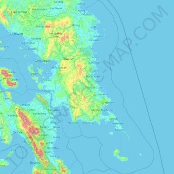
Name: Eastern Samar topographic map, elevation, terrain.
Location: Eastern Samar, Eastern Visayas, Philippines (10.55220 125.11873 12.42366 126.10507)
Average elevation: 61 m
Minimum elevation: -1 m
Maximum elevation: 1,250 m
Thank you for supporting this site ❤️
Make a donation
Make a donation
Other topographic maps
Click on a map to view its topography, its elevation and its terrain.