
Ayres topographic map
Interactive map
Click on the map to display elevation.
About this map
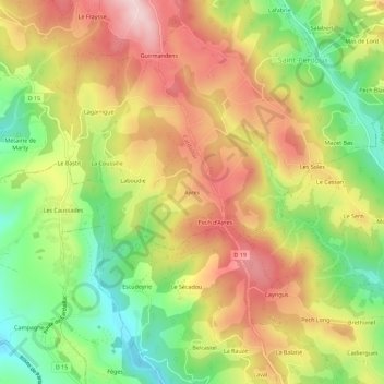
Name: Ayres topographic map, elevation, terrain.
Average elevation: 384 m
Minimum elevation: 244 m
Maximum elevation: 521 m
Other topographic maps
Click on a map to view its topography, its elevation and its terrain.
Bennevioles
France > Occitanie > Lot > Cardaillac
Bennevioles, Cardaillac, Figeac, Lot, Occitanie, France métropolitaine, 46100, France
Average elevation: 460 m