
Thank you for supporting this site ❤️
Make a donation
Make a donation
Long Neck topographic map
Click on the map to display elevation.
Thank you for supporting this site ❤️
Make a donation
Make a donation
About this map
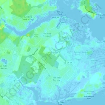
Name: Long Neck topographic map, elevation, terrain.
Location: Long Neck, Sussex County, Delaware, United States (38.60943 -75.17097 38.64943 -75.13097)
Average elevation: 3 m
Minimum elevation: -7 m
Maximum elevation: 15 m
Thank you for supporting this site ❤️
Make a donation
Make a donation
Other topographic maps
Click on a map to view its topography, its elevation and its terrain.