
Wolvenberg topographic map
Interactive map
Click on the map to display elevation.
About this map
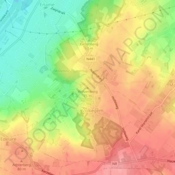
Name: Wolvenberg topographic map, elevation, terrain.
Location: Wolvenberg, Oudenaarde, East Flanders, Flanders, 9700, Belgium (50.84241 3.64213 50.84251 3.64223)
Average elevation: 55 m
Minimum elevation: -1 m
Maximum elevation: 97 m