
Make a donation
Semmering topographic map
Click on the map to display elevation.
Make a donation
Semmering
Semmering is located on the border of Lower Austria and Styria at an elevation of 1,000 m (3,280 ft) above sea level and surrounded with forest. Semmering city is located in Neunkirchen, about 100 km (60 mi) from Vienna.
Make a donation
About this map
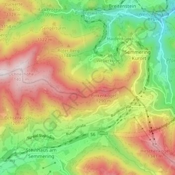
Name: Semmering topographic map, elevation, terrain.
Location: Semmering, Bezirk Neunkirchen, Lower Austria, 2680, Austria (47.61810 15.78132 47.65734 15.85002)
Average elevation: 1,001 m
Minimum elevation: 653 m
Maximum elevation: 1,401 m
Make a donation
Other topographic maps
Click on a map to view its topography, its elevation and its terrain.
Wechsel
Austria > Lower Austria > Bezirk Neunkirchen > Mönichkirchen > Pfeffergraben
The Wechsel Pass (elevation 980 m, 3,215 ft) is a mountain pass in the Austrian Alps, located between the Bundesländer of Lower Austria and Styria.
Average elevation: 906 m
Klosterwappen
Austria > Lower Austria > Bezirk Neunkirchen > Gemeinde Reichenau an der Rax
A rack-and-pinion railway, the Schneeberg Railway, now over 100 years old, climbs to a height of 1,800 m (5,900 ft), reducing the walk to the summit to an hour or two. There are also a number of other routes for walkers, including from the spa resort of Puchberg am Schneeberg to the east, or from the south, in…
Average elevation: 1,715 m
Sonnleiten
Austria > Lower Austria > Bezirk Neunkirchen > Gemeinde Schwarzau im Gebirge
Average elevation: 872 m
Make a donation