
El Bouni topographic map
Interactive map
Click on the map to display elevation.
About this map
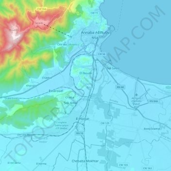
Name: El Bouni topographic map, elevation, terrain.
Location: El Bouni, Daïra El Bouni, Annaba, Algérie (36.79635 7.58915 36.88512 7.83015)
Average elevation: 98 m
Minimum elevation: -2 m
Maximum elevation: 1,001 m