
Thank you for supporting this site ❤️
Make a donation
Make a donation
Muttom topographic map
Click on the map to display elevation.
Thank you for supporting this site ❤️
Make a donation
Make a donation
About this map
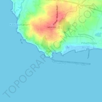
Name: Muttom topographic map, elevation, terrain.
Location: Muttom, Kalkulam, Kanniyakumari, Tamil Nadu, 629202, India (8.10423 77.29781 8.14423 77.33781)
Average elevation: 13 m
Minimum elevation: -1 m
Maximum elevation: 71 m
Thank you for supporting this site ❤️
Make a donation
Make a donation