
Thank you for supporting this site ❤️
Make a donation
Make a donation
Mukwonago topographic map
Click on the map to display elevation.
Thank you for supporting this site ❤️
Make a donation
Make a donation
About this map
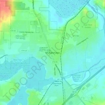
Name: Mukwonago topographic map, elevation, terrain.
Location: Mukwonago, Waukesha County, Wisconsin, 53149, United States (42.84668 -88.35343 42.88668 -88.31343)
Average elevation: 250 m
Minimum elevation: 235 m
Maximum elevation: 297 m
Thank you for supporting this site ❤️
Make a donation
Make a donation