
拉乌彝族乡 topographic map
Interactive map
Click on the map to display elevation.
About this map
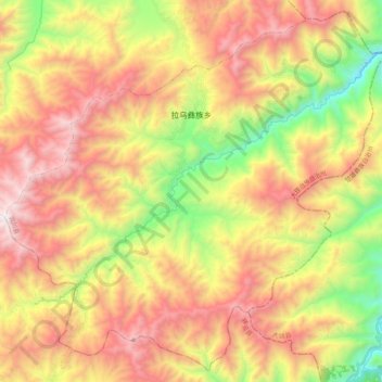
Name: 拉乌彝族乡 topographic map, elevation, terrain.
Location: 拉乌彝族乡, 宾川县, 大理白族自治州, Yunnan, China (25.79680 100.75497 25.97440 100.96468)
Average elevation: 2,330 m
Minimum elevation: 1,417 m
Maximum elevation: 3,218 m