
Thank you for supporting this site ❤️
Make a donation
Make a donation
Green Pond topographic map
Click on the map to display elevation.
Thank you for supporting this site ❤️
Make a donation
Make a donation
About this map
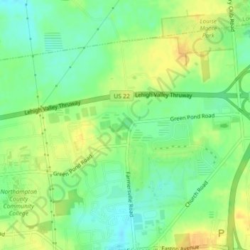
Name: Green Pond topographic map, elevation, terrain.
Average elevation: 124 m
Minimum elevation: 109 m
Maximum elevation: 138 m
Thank you for supporting this site ❤️
Make a donation
Make a donation
Other topographic maps
Click on a map to view its topography, its elevation and its terrain.
Middletown
United States > Pennsylvania > Northampton County > Bethlehem Township > Butztown
Average elevation: 103 m
Butztown
United States > Pennsylvania > Northampton County > Bethlehem Township
Average elevation: 110 m