
Thank you for supporting this site ❤️
Make a donation
Make a donation
Hurricane topographic map
Click on the map to display elevation.
Thank you for supporting this site ❤️
Make a donation
Make a donation
About this map
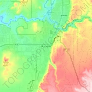
Name: Hurricane topographic map, elevation, terrain.
Location: Hurricane, Washington County, Utah, 84745, United States (37.13503 -113.32989 37.21503 -113.24989)
Average elevation: 1,075 m
Minimum elevation: 879 m
Maximum elevation: 1,334 m
Thank you for supporting this site ❤️
Make a donation
Make a donation