
Kiesgrube Steinheide topographic map
Interactive map
Click on the map to display elevation.
About this map
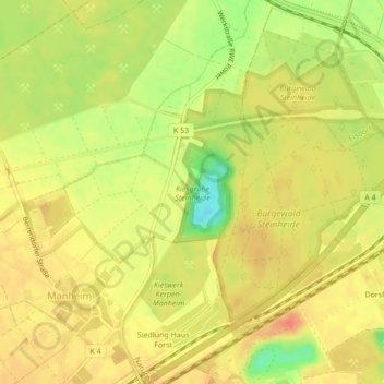
Name: Kiesgrube Steinheide topographic map, elevation, terrain.
Average elevation: 89 m
Minimum elevation: 58 m
Maximum elevation: 105 m
Other topographic maps
Click on a map to view its topography, its elevation and its terrain.
Manheim
Deutschland > Nordrhein-Westfalen > Rhein-Erft-Kreis > Kerpen > Manheim
Manheim, Kerpen, Rhein-Erft-Kreis, Nordrhein-Westfalen, 50170, Deutschland
Average elevation: 94 m