
Rabenkopf topographic map
Interactive map
Click on the map to display elevation.
About this map
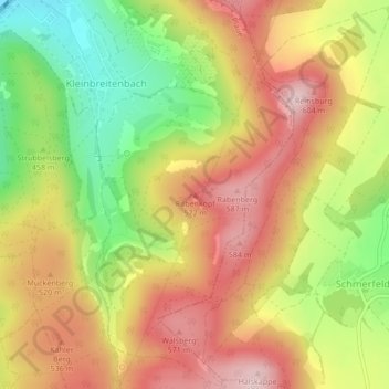
Name: Rabenkopf topographic map, elevation, terrain.
Average elevation: 479 m
Minimum elevation: 331 m
Maximum elevation: 602 m
Other topographic maps
Click on a map to view its topography, its elevation and its terrain.
Spring von Plaue
Deutschland > Thüringen > Ilm-Kreis > Plaue
Spring von Plaue, L 2149, Liebenstein, Plaue, Geratal/Plaue, Ilm-Kreis, Thüringen, 99338, Deutschland
Average elevation: 390 m
Kleinbreitenbach
Deutschland > Thüringen > Ilm-Kreis > Plaue > Kleinbreitenbach
Kleinbreitenbach, Plaue, Geratal/Plaue, Ilm-Kreis, Thüringen, 99338, Deutschland
Average elevation: 436 m