
Make a donation
Magothy River topographic map
Click on the map to display elevation.
Make a donation
Magothy River
Almost all of the creeks and tidal coves on the Magothy are named, partly as the result of a project started in 2001 by the Magothy River Association. They are shown on a map produced as part of that project, and the major ones are shown on the USGS topographic map.
Make a donation
About this map
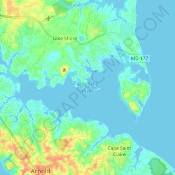
Name: Magothy River topographic map, elevation, terrain.
Average elevation: 9 m
Minimum elevation: -3 m
Maximum elevation: 46 m
Make a donation
Other topographic maps
Click on a map to view its topography, its elevation and its terrain.
Lower Magothy Beach
United States > Maryland > Anne Arundel County > Severna Park > Lower Magothy Beach
Average elevation: 9 m
Windrush Farm
United States > Maryland > Anne Arundel County > Severna Park > Windrush Farm
Average elevation: 10 m
Make a donation
Severndale
United States > Maryland > Anne Arundel County > Severna Park > Severndale
Average elevation: 18 m
Linstead-on-the-Severn
United States > Maryland > Anne Arundel County > Severna Park
Average elevation: 11 m