
Schlosshorn topographic map
Interactive map
Click on the map to display elevation.
About this map
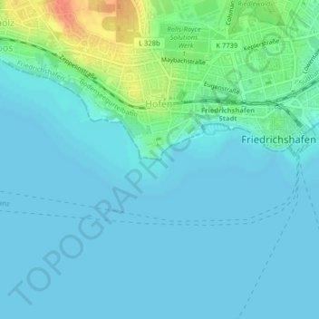
Name: Schlosshorn topographic map, elevation, terrain.
Average elevation: 400 m
Minimum elevation: 392 m
Maximum elevation: 437 m
Other topographic maps
Click on a map to view its topography, its elevation and its terrain.
Appenweiler
Deutschland > Baden-Württemberg > Bodenseekreis > Friedrichshafen > Appenweiler
Appenweiler, Friedrichshafen, Verwaltungsgemeinschaft Friedrichshafen, Bodenseekreis, Baden-Württemberg, 88048, Deutschland
Average elevation: 456 m