
Schönenborn topographic map
Interactive map
Click on the map to display elevation.
About this map
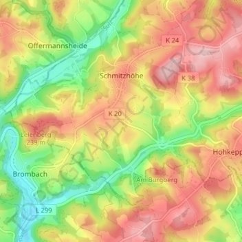
Name: Schönenborn topographic map, elevation, terrain.
Average elevation: 189 m
Minimum elevation: 101 m
Maximum elevation: 268 m
Schönenborn liegt im westlichen Lindlar nahe der größeren Ortschaft Schmitzhöhe an der Kreisstraße 20. Weitere Nachbarorte sind Sieferhof, Holl, Köttingen, Leienhöhe, Kalkofen und Berghausen.