
Lac de Fort-du-Plasne topographic map
Interactive map
Click on the map to display elevation.
About this map
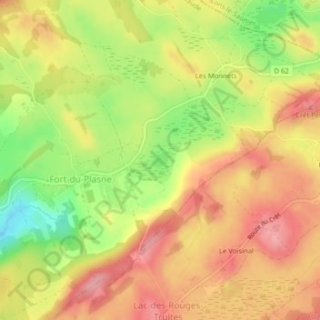
Name: Lac de Fort-du-Plasne topographic map, elevation, terrain.
Average elevation: 905 m
Minimum elevation: 834 m
Maximum elevation: 955 m
Other topographic maps
Click on a map to view its topography, its elevation and its terrain.
La Lemme
France > Bourgogne-Franche-Comté > Jura > Fort-du-Plasne
La Lemme, Fort-du-Plasne, Saint-Claude, Jura, Bourgogne-Franche-Comté, France métropolitaine, 39150, France
Average elevation: 849 m