
Thank you for supporting this site ❤️
Make a donation
Make a donation
Gilmore City topographic map
Click on the map to display elevation.
Thank you for supporting this site ❤️
Make a donation
Make a donation
About this map
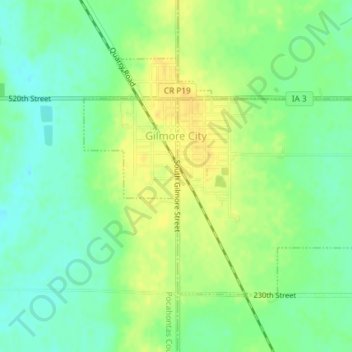
Name: Gilmore City topographic map, elevation, terrain.
Location: Gilmore City, Pocahontas County, Iowa, United States (42.71734 -94.45291 42.73549 -94.42289)
Average elevation: 368 m
Minimum elevation: 355 m
Maximum elevation: 380 m
Thank you for supporting this site ❤️
Make a donation
Make a donation