Geolocate

Dike topographic map

Interactive map

Click on the map to display elevation.

About this map

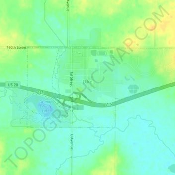
Name: Dike topographic map, elevation, terrain.

Location: Dike, Grundy County, Iowa, United States (42.45642 -92.64194 42.46977 -92.60244)

Average elevation: 291 m

Minimum elevation: 281 m

Maximum elevation: 305 m

Other topographic maps

Click on a map to view its topography, its elevation and its terrain.

Grundy Center

United States > Iowa > Grundy County

Grundy Center, Grundy County, Iowa, United States

Average elevation: 306 m

Beaman

United States > Iowa > Grundy County

Beaman, Grundy County, Iowa, United States

Average elevation: 309 m

Wellsburg

United States > Iowa > Grundy County

Wellsburg, Grundy County, Iowa, United States

Average elevation: 327 m

Holland

United States > Iowa > Grundy County

Holland, Grundy County, Iowa, United States

Average elevation: 310 m

Reinbeck

United States > Iowa > Grundy County

Reinbeck, Grundy County, Iowa, 50669, United States

Average elevation: 290 m

Conrad

United States > Iowa > Grundy County

Conrad, Grundy County, Iowa, 50621, United States

Average elevation: 313 m

Stout

United States > Iowa > Grundy County

Stout, Grundy County, Iowa, 50673, United States

Average elevation: 309 m

Morrison

United States > Iowa > Grundy County

Morrison, Grundy County, Iowa, 50657, United States

Average elevation: 295 m