
Thank you for supporting this site ❤️
Make a donation
Make a donation
A Fonsagrada topographic map
Click on the map to display elevation.
Thank you for supporting this site ❤️
Make a donation
Make a donation
About this map
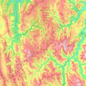
Name: A Fonsagrada topographic map, elevation, terrain.
Location: A Fonsagrada, Lugo, Galicien, Spanien (42.98800 -7.21265 43.30699 -6.93814)
Average elevation: 648 m
Minimum elevation: 131 m
Maximum elevation: 1,193 m
Thank you for supporting this site ❤️
Make a donation
Make a donation
Other topographic maps
Click on a map to view its topography, its elevation and its terrain.