
Thank you for supporting this site ❤️
Make a donation
Make a donation
Granite Shoals topographic map
Click on the map to display elevation.
Thank you for supporting this site ❤️
Make a donation
Make a donation
About this map
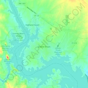
Name: Granite Shoals topographic map, elevation, terrain.
Location: Granite Shoals, Burnet County, Texas, United States (30.56776 -98.41310 30.61502 -98.32338)
Average elevation: 263 m
Minimum elevation: 244 m
Maximum elevation: 321 m
Thank you for supporting this site ❤️
Make a donation
Make a donation
Other topographic maps
Click on a map to view its topography, its elevation and its terrain.