
Thank you for supporting this site ❤️
Make a donation
Make a donation
Al Ghallah topographic map
Click on the map to display elevation.
Thank you for supporting this site ❤️
Make a donation
Make a donation
About this map
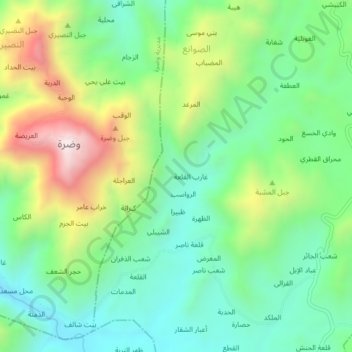
Name: Al Ghallah topographic map, elevation, terrain.
Location: Al Ghallah, Mabyan District, Hajjah Governorate, Yemen (15.68706 43.47590 15.72706 43.51590)
Average elevation: 795 m
Minimum elevation: 523 m
Maximum elevation: 1,327 m
Thank you for supporting this site ❤️
Make a donation
Make a donation
Other topographic maps
Click on a map to view its topography, its elevation and its terrain.