
Montero topographic map
Interactive map
Click on the map to display elevation.
About this map
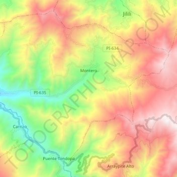
Name: Montero topographic map, elevation, terrain.
Location: Montero, Ayabaca, Piura, Perú (-4.71091 -79.90876 -4.58304 -79.76281)
Average elevation: 1,626 m
Minimum elevation: 589 m
Maximum elevation: 2,800 m
Other topographic maps
Click on a map to view its topography, its elevation and its terrain.
Naranjo de Chonta
Naranjo de Chonta, Montero, Ayabaca, Piura, Perú
Average elevation: 1,518 m