
D 45 topographic map
Interactive map
Click on the map to display elevation.
About this map
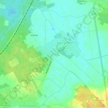
Name: D 45 topographic map, elevation, terrain.
Location: D 45, Neuhausen/Spree, Spree-Neiße, Brandebourg, Allemagne (51.66463 14.33981 51.66473 14.33991)
Average elevation: 99 m
Minimum elevation: 88 m
Maximum elevation: 119 m
Other topographic maps
Click on a map to view its topography, its elevation and its terrain.
D 21
Allemagne > Brandebourg > Neuhausen/Spree
D 21, Neuhausen/Spree, Spree-Neiße, Brandebourg, 03058, Allemagne
Average elevation: 93 m
D 90
Allemagne > Brandebourg > Neuhausen/Spree
D 90, Neuhausen/Spree, Spree-Neiße, Brandebourg, 03051, Allemagne
Average elevation: 91 m