
Thank you for supporting this site ❤️
Make a donation
Make a donation
Valk topographic map
Click on the map to display elevation.
Thank you for supporting this site ❤️
Make a donation
Make a donation
About this map
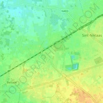
Name: Valk topographic map, elevation, terrain.
Location: Valk, Belsele, Sint-Niklaas, Oost-Vlaanderen, 9111, België (51.13830 4.09437 51.17830 4.13437)
Average elevation: 16 m
Minimum elevation: 4 m
Maximum elevation: 30 m
Thank you for supporting this site ❤️
Make a donation
Make a donation
Other topographic maps
Click on a map to view its topography, its elevation and its terrain.