
Thank you for supporting this site ❤️
Make a donation
Make a donation
Aisthofen topographic map
Click on the map to display elevation.
Thank you for supporting this site ❤️
Make a donation
Make a donation
About this map
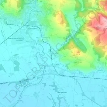
Name: Aisthofen topographic map, elevation, terrain.
Location: Aisthofen, Perg, Bezirk Perg, Upper Austria, 4320, Austria (48.23844 14.57147 48.27844 14.61147)
Average elevation: 271 m
Minimum elevation: 238 m
Maximum elevation: 398 m
Thank you for supporting this site ❤️
Make a donation
Make a donation