
Astwood Bank topographic map
Interactive map
Click on the map to display elevation.
About this map
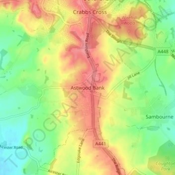
Name: Astwood Bank topographic map, elevation, terrain.
Average elevation: 108 m
Minimum elevation: 64 m
Maximum elevation: 155 m
Other topographic maps
Click on a map to view its topography, its elevation and its terrain.
Callow Hill
United Kingdom > England > Worcestershire > Redditch
Callow Hill, Redditch, Worcestershire, England, B97 5YX, United Kingdom
Average elevation: 118 m
Feckenham
United Kingdom > England > Worcestershire > Redditch
Feckenham, Redditch, Worcestershire, England, United Kingdom
Average elevation: 87 m