
Sigsiloma topographic map
Interactive map
Click on the map to display elevation.
About this map
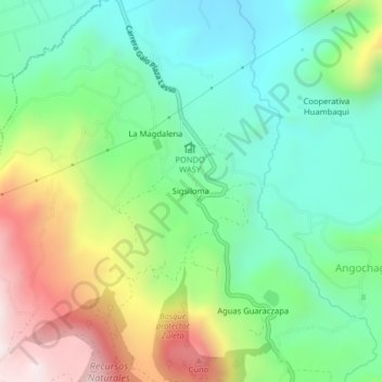
Name: Sigsiloma topographic map, elevation, terrain.
Location: Sigsiloma, Angochagua, Ibarra, Imbabura, 100152, Ecuador (0.22658 -78.11794 0.26658 -78.07794)
Average elevation: 2,878 m
Minimum elevation: 2,585 m
Maximum elevation: 3,427 m
Other topographic maps
Click on a map to view its topography, its elevation and its terrain.
Rumiloma
Ecuador > Imbabura > Ibarra > Angochagua
Rumiloma, Angochagua, Ibarra, Imbabura, Ecuador
Average elevation: 3,665 m