
Les Chazeaux topographic map
Interactive map
Click on the map to display elevation.
About this map
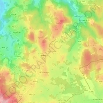
Name: Les Chazeaux topographic map, elevation, terrain.
Average elevation: 679 m
Minimum elevation: 592 m
Maximum elevation: 761 m
Other topographic maps
Click on a map to view its topography, its elevation and its terrain.
La Chaumette
France > Nouvelle-Aquitaine > Creuse > Dontreix
La Chaumette, Dontreix, Aubusson, Creuse, Nouvelle-Aquitaine, France métropolitaine, 23700, France
Average elevation: 581 m