
Condé-sur-Huisne topographic map
Interactive map
Click on the map to display elevation.
About this map
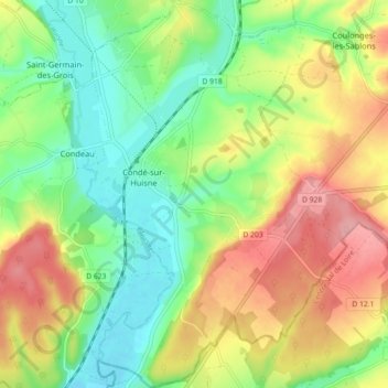
Name: Condé-sur-Huisne topographic map, elevation, terrain.
Average elevation: 159 m
Minimum elevation: 107 m
Maximum elevation: 228 m
Other topographic maps
Click on a map to view its topography, its elevation and its terrain.
La Masure
France > Normandie > Orne > Sablons sur Huisne
La Masure, Coulonges-les-Sablons, Sablons sur Huisne, Mortagne-au-Perche, Orne, Normandie, France métropolitaine, 61110, France
Average elevation: 193 m