
Thank you for supporting this site ❤️
Make a donation
Make a donation
Plymouth topographic map
Click on the map to display elevation.
Thank you for supporting this site ❤️
Make a donation
Make a donation
About this map
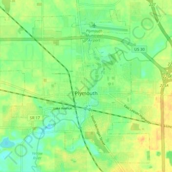
Name: Plymouth topographic map, elevation, terrain.
Location: Plymouth, Marshall County, Indiana, 46563, United States (41.32052 -86.35762 41.37135 -86.28176)
Average elevation: 247 m
Minimum elevation: 233 m
Maximum elevation: 261 m
Thank you for supporting this site ❤️
Make a donation
Make a donation