
Thank you for supporting this site ❤️
Make a donation
Make a donation
Kandukur topographic map
Click on the map to display elevation.
Thank you for supporting this site ❤️
Make a donation
Make a donation
Kandukur
Kandukuru (earlier known as Skandapuri) is located at 15°12′59″N 79°54′15″E / 15.2165°N 79.9042°E / 15.2165; 79.9042. It has an average elevation of 13 metres (43 ft). Kandukur was a part of the erstwhile Nellore district and was then included in the newly carved out Prakasam District in 1970. Later as a part of the district's reorganization in 2022, it is now merged with the residual SPSR Nellore district. The total geographical area of Kandukur Municipality is 37.63 sq km.
Thank you for supporting this site ❤️
Make a donation
Make a donation
About this map
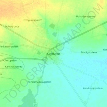
Name: Kandukur topographic map, elevation, terrain.
Average elevation: 18 m
Minimum elevation: 7 m
Maximum elevation: 36 m
Thank you for supporting this site ❤️
Make a donation
Make a donation
Other topographic maps
Click on a map to view its topography, its elevation and its terrain.