
Thank you for supporting this site ❤️
Make a donation
Make a donation
Zonhoven topographic map
Click on the map to display elevation.
Thank you for supporting this site ❤️
Make a donation
Make a donation
About this map
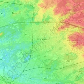
Name: Zonhoven topographic map, elevation, terrain.
Location: Zonhoven, Hasselt, Limburg, Flanders, 3520, Belgium (50.96283 5.30104 51.01249 5.46597)
Average elevation: 46 m
Minimum elevation: 22 m
Maximum elevation: 83 m
Thank you for supporting this site ❤️
Make a donation
Make a donation