
Eschbach topographic map
Interactive map
Click on the map to display elevation.
About this map
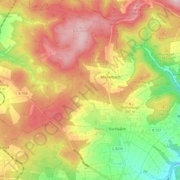
Name: Eschbach topographic map, elevation, terrain.
Location: Eschbach, Usingen, Hochtaunuskreis, Hessen, Deutschland (50.34092 8.49238 50.39822 8.56991)
Average elevation: 385 m
Minimum elevation: 239 m
Maximum elevation: 509 m
Other topographic maps
Click on a map to view its topography, its elevation and its terrain.
Merzhausen
Deutschland > Hessen > Hochtaunuskreis > Usingen
Merzhausen, Usingen, Hochtaunuskreis, Hessen, 61267, Deutschland
Average elevation: 398 m
Michelbach
Deutschland > Hessen > Hochtaunuskreis > Usingen > Michelbach
Michelbach, Usingen, Hochtaunuskreis, Hessen, 61250, Deutschland
Average elevation: 396 m