
Thank you for supporting this site ❤️
Make a donation
Make a donation
Carhoo topographic map
Click on the map to display elevation.
Thank you for supporting this site ❤️
Make a donation
Make a donation
About this map
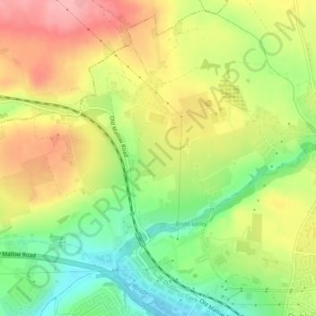
Name: Carhoo topographic map, elevation, terrain.
Location: Carhoo, Whitechurch, Cork, County Cork, Munster, Ireland (51.92637 -8.49221 51.94109 -8.47754)
Average elevation: 81 m
Minimum elevation: 21 m
Maximum elevation: 142 m
Thank you for supporting this site ❤️
Make a donation
Make a donation
Other topographic maps
Click on a map to view its topography, its elevation and its terrain.
Thank you for supporting this site ❤️
Make a donation
Make a donation
Thank you for supporting this site ❤️
Make a donation
Make a donation