
Thank you for supporting this site ❤️
Make a donation
Make a donation
Deer topographic map
Click on the map to display elevation.
Thank you for supporting this site ❤️
Make a donation
Make a donation
About this map
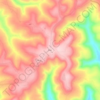
Name: Deer topographic map, elevation, terrain.
Location: Deer, Newton County, Arkansas, 72628, United States (35.80675 -93.22934 35.84675 -93.18934)
Average elevation: 639 m
Minimum elevation: 463 m
Maximum elevation: 723 m
Thank you for supporting this site ❤️
Make a donation
Make a donation
Other topographic maps
Click on a map to view its topography, its elevation and its terrain.