
Thank you for supporting this site ❤️
Make a donation
Make a donation
Los Morales topographic map
Click on the map to display elevation.
Thank you for supporting this site ❤️
Make a donation
Make a donation
About this map
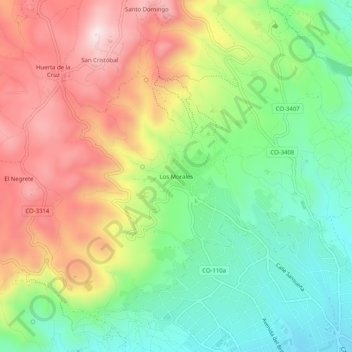
Name: Los Morales topographic map, elevation, terrain.
Location: Los Morales, Córdoba, Andalucía, 14012, España (37.90874 -4.82877 37.94874 -4.78877)
Average elevation: 369 m
Minimum elevation: 162 m
Maximum elevation: 629 m
Thank you for supporting this site ❤️
Make a donation
Make a donation
Other topographic maps
Click on a map to view its topography, its elevation and its terrain.