
Thank you for supporting this site ❤️
Make a donation
Make a donation
Frye Island topographic map
Click on the map to display elevation.
Thank you for supporting this site ❤️
Make a donation
Make a donation
About this map
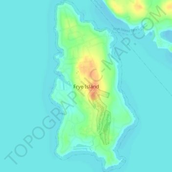
Name: Frye Island topographic map, elevation, terrain.
Location: Frye Island, Cumberland County, Maine, 04071, United States (43.82219 -70.53454 43.85400 -70.51150)
Average elevation: 85 m
Minimum elevation: 76 m
Maximum elevation: 119 m
Thank you for supporting this site ❤️
Make a donation
Make a donation
Other topographic maps
Click on a map to view its topography, its elevation and its terrain.
Thank you for supporting this site ❤️
Make a donation
Make a donation
Littlejohn Island
United States > Maine > Cumberland County > Yarmouth > Cousins Island
Average elevation: 5 m
Thank you for supporting this site ❤️
Make a donation
Make a donation