
Thank you for supporting this site ❤️
Make a donation
Make a donation
Nobleboro topographic map
Click on the map to display elevation.
Thank you for supporting this site ❤️
Make a donation
Make a donation
About this map
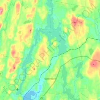
Name: Nobleboro topographic map, elevation, terrain.
Location: Nobleboro, Lincoln County, Maine, 04555, United States (44.05613 -69.53198 44.16504 -69.43218)
Average elevation: 40 m
Minimum elevation: -4 m
Maximum elevation: 121 m
Thank you for supporting this site ❤️
Make a donation
Make a donation
Other topographic maps
Click on a map to view its topography, its elevation and its terrain.
Thank you for supporting this site ❤️
Make a donation
Make a donation
Monhegan Island
United States > Maine > Lincoln County > Monhegan Island Plantation > Monhegan
Average elevation: 5 m
Thank you for supporting this site ❤️
Make a donation
Make a donation