
Ighil Nacer topographic map
Interactive map
Click on the map to display elevation.
About this map
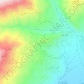
Name: Ighil Nacer topographic map, elevation, terrain.
Location: Ighil Nacer, Ighram, Daïra Akbou, Béjaïa, 06057, Algérie (36.43890 4.47074 36.47890 4.51074)
Average elevation: 498 m
Minimum elevation: 211 m
Maximum elevation: 1,033 m