
Thank you for supporting this site ❤️
Make a donation
Make a donation
Graceham topographic map
Click on the map to display elevation.
Thank you for supporting this site ❤️
Make a donation
Make a donation
About this map
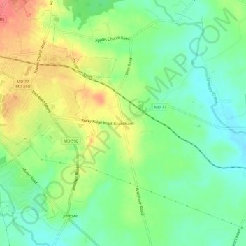
Name: Graceham topographic map, elevation, terrain.
Location: Graceham, Frederick County, Maryland, 21788, United States (39.59427 -77.40165 39.63427 -77.36165)
Average elevation: 131 m
Minimum elevation: 102 m
Maximum elevation: 172 m
Thank you for supporting this site ❤️
Make a donation
Make a donation
Other topographic maps
Click on a map to view its topography, its elevation and its terrain.
Monocacy River
United States > Maryland > Frederick County > Bartonsville > Pine Cliff
Average elevation: 97 m
Thank you for supporting this site ❤️
Make a donation
Make a donation
Thank you for supporting this site ❤️
Make a donation
Make a donation