
Herzhausen topographic map
Interactive map
Click on the map to display elevation.
About this map
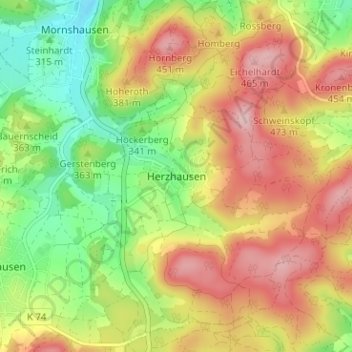
Name: Herzhausen topographic map, elevation, terrain.
Location: Herzhausen, Regierungsbezirk Gießen, Hessen, 35232, Deutschland (50.80449 8.53787 50.84449 8.57787)
Average elevation: 363 m
Minimum elevation: 263 m
Maximum elevation: 466 m