
Toén topographic map
Interactive map
Click on the map to display elevation.
About this map
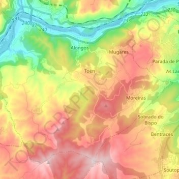
Name: Toén topographic map, elevation, terrain.
Location: Toén, Ourense, Galicien, 32930, Spanien (42.26601 -8.02332 42.34473 -7.89391)
Average elevation: 348 m
Minimum elevation: 85 m
Maximum elevation: 625 m