
Thank you for supporting this site ❤️
Make a donation
Make a donation
Hyon topographic map
Click on the map to display elevation.
Thank you for supporting this site ❤️
Make a donation
Make a donation
About this map
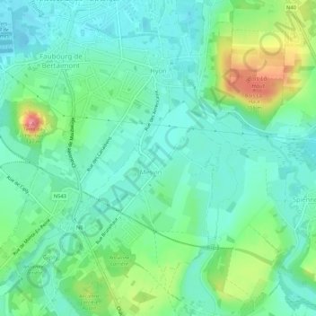
Name: Hyon topographic map, elevation, terrain.
Location: Hyon, Bergen, Henegouwen, Wallonië, België (50.41311 3.92838 50.44653 3.98150)
Average elevation: 52 m
Minimum elevation: 26 m
Maximum elevation: 120 m
Thank you for supporting this site ❤️
Make a donation
Make a donation
Other topographic maps
Click on a map to view its topography, its elevation and its terrain.
Thank you for supporting this site ❤️
Make a donation
Make a donation
Thank you for supporting this site ❤️
Make a donation
Make a donation
Sirault
België > Henegouwen > Bergen > Saint-Ghislain
De hoogte aan de kerk bedraagt 67 meter.
Average elevation: 74 m
Thank you for supporting this site ❤️
Make a donation
Make a donation
Thank you for supporting this site ❤️
Make a donation
Make a donation