
Savannakhet Province topographic map
Interactive map
Click on the map to display elevation.
About this map
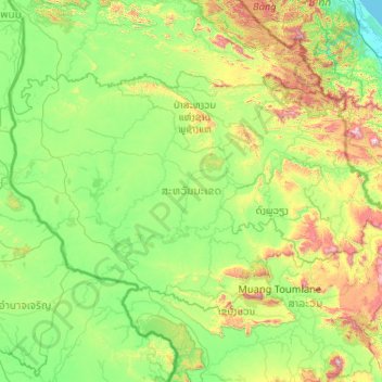
Name: Savannakhet Province topographic map, elevation, terrain.
Location: Savannakhet Province, Laos (15.87679 104.73328 17.12345 106.79878)
Average elevation: 271 m
Minimum elevation: 0 m
Maximum elevation: 1,588 m
Other topographic maps
Click on a map to view its topography, its elevation and its terrain.