
Garganta de los Montes topographic map
Interactive map
Click on the map to display elevation.
About this map
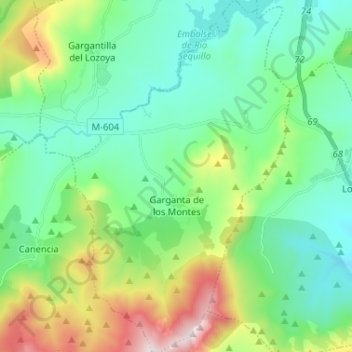
Name: Garganta de los Montes topographic map, elevation, terrain.
Average elevation: 1,191 m
Minimum elevation: 964 m
Maximum elevation: 1,825 m
Garganta de los Montes liegt etwa 75 Kilometer nordnordöstlich von Madrid in einer Höhe von ca. 1135 m. Im Norden der Gemeinde befindet sich die Talsperre Riosequillo.