
Thank you for supporting this site ❤️
Make a donation
Make a donation
Lawai topographic map
Click on the map to display elevation.
Thank you for supporting this site ❤️
Make a donation
Make a donation
About this map
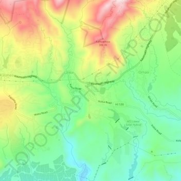
Name: Lawai topographic map, elevation, terrain.
Location: Lawai, Kauaʻi County, Hawaii, 96765, United States (21.89548 -159.52513 21.94664 -159.47183)
Average elevation: 178 m
Minimum elevation: 9 m
Maximum elevation: 429 m
Thank you for supporting this site ❤️
Make a donation
Make a donation