Geolocate

Aven topographic map

Interactive map

Click on the map to display elevation.

About this map

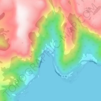
Name: Aven topographic map, elevation, terrain.

Location: Aven, Høyanger, Vestland, Norvège (61.13341 5.60239 61.17341 5.64239)

Average elevation: 292 m

Minimum elevation: 0 m

Maximum elevation: 750 m

Other topographic maps

Click on a map to view its topography, its elevation and its terrain.

Stryn

Norvège > Vestland

Stryn, Vestland, Norvège

Average elevation: 882 m

Etne

Norvège > Vestland

Etne, Vestland, Norvège

Average elevation: 703 m

Luster

Norvège > Vestland

Luster, Vestland, Norvège

Average elevation: 1,126 m

Aurland

Norvège > Vestland

Aurland, Vestland, Norvège

Average elevation: 1,102 m

Bergen

Norvège > Vestland

Bergen, Vestland, Norvège

Average elevation: 125 m