
Casais e Alviobeira topographic map
Interactive map
Click on the map to display elevation.
About this map
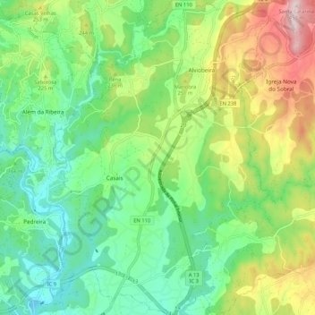
Name: Casais e Alviobeira topographic map, elevation, terrain.
Location: Casais e Alviobeira, Tomar, Santarém, Portugal (39.61708 -8.40447 39.69779 -8.33059)
Average elevation: 181 m
Minimum elevation: 48 m
Maximum elevation: 440 m
Other topographic maps
Click on a map to view its topography, its elevation and its terrain.
Mata Nacional dos Sete Montes
Portugal > Santarém > Tomar > Casal dos Peixinhos
Mata Nacional dos Sete Montes, Casal dos Peixinhos, Tomar (São João Baptista) e Santa Maria dos Olivais, Tomar, Santarém, 2300-551, Portugal
Average elevation: 102 m
Fonte São Miguel
Fonte São Miguel, Carregueiros, Tomar, Santarém, 2305-176, Portugal
Average elevation: 162 m