
Thank you for supporting this site ❤️
Make a donation
Make a donation
Kessel-Lo topographic map
Click on the map to display elevation.
Thank you for supporting this site ❤️
Make a donation
Make a donation
About this map
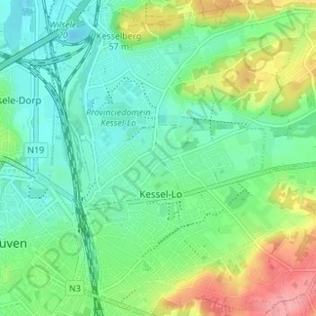
Name: Kessel-Lo topographic map, elevation, terrain.
Location: Kessel-Lo, Louvain, Brabant flamand, Flandre, 3010, Belgique (50.87028 4.70903 50.90916 4.77053)
Average elevation: 39 m
Minimum elevation: 10 m
Maximum elevation: 101 m
Thank you for supporting this site ❤️
Make a donation
Make a donation
Other topographic maps
Click on a map to view its topography, its elevation and its terrain.